

So It Begins!
My buddy Michael (trail name: “Dominion”) accompanied me on the Desolation Wilderness section of the TYT (Meeks Bay to Echo Lake) on a backpacking trip from October 17-20, 2022. I had a decent schedule laid out – and while we had a few backup plans, they turned out not to be needed. We completed each segment of this section as planned, and I still believe this to be a great balance of distance, elevation, water, campsites, etc. (and it was nice to have a somewhat relaxed hike out the last day!).

Incredibly, only a few days before we departed, my wife found the Desolation Wilderness map my dad had given me. It had been missing for well over a year. Before I even opened it all the way I saw that Dad had the TYT marked out. I was overcome with gratitude – what a treasure! I carefully packed it and kept it with me the whole trip.

Arrival
My mother graciously offered to drive us up to Meek’s Bay so we could leave a car at the Echo Lake parking lot. This saved about an hour and a half of driving at the end of our hike which allowed us to find food before we hurt somebody. The drive up to Tahoe began at 6am and we were on trail at 11am. A late start to be sure, but all we needed to do was set up camp before dark.
Setting Out
The beginning of “the trail” was more of a mile or so long dirt road through the woods. The trail lies in between a northern ridge and Meek’s Creek (which was nearly dry this October). Eventually the proper trail begins to climb the side of the ridge and we felt like we were really on the TYT.
The trail eventually reached a sign-festooned junction and so begins a 3 mile climb of about 1000’ to the first major feature: Lake Genevieve. It was here that we saw the first sign (literally) of the TYT: the initials “TYTR” buried under a rock pile at the bottom of a wooden post. Now, according to the Tahoe-To-Whitney website, “There are only two signs naming, citing, or identifying the route of the Tahoe to Yosemite Trail along the whole length of the TYT from Meeks Bay to Tuolumne Meadows. The first one is shown above at this first trail junction South of the Meeks Bay Trailhead, while the second is located just above Highway 4.” They show a picture of this first sign, but it is apparently not there anymore.

Water, Water, Everywhere
In less than a mile we hiked past three more lakes past Genevieve: Crag, Hidden (which we only caught a quick glimpse of down inside a canyon to the west after turning left at a fork), and Shadow. Meeks creek feeds all of these beauties. Not far past Shadow Lake was the final and largest lake of this grouping: Stony Ridge. We took a use trail to the left to a small dam at the lake’s outlet. It made for a great rest and snack spot.

First Camp
Although it was tempting to drop our bags and set up camp here (a constant temptation all along this route), we decided to push on to our planned destination. Another mile and a half from the dam and 500′ brought us to Rubicon Lake. We left the trail and picked our way along the northern outlet and found several decent campsite possibilities. As always, however, Dominion found us an epic site with a “deck rock” that made for a perfect kitchen / dining room.
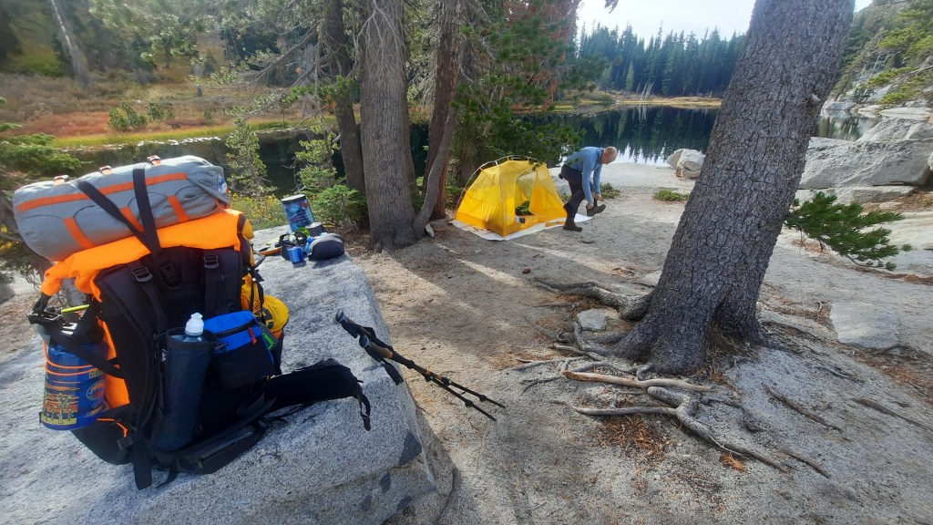
We set up our tents, made some food (including a fish Dominion caught!), hiked up higher into the rocks to see the Milky Way, stored our bear cans, and turned in for the night.
