
So Here’s What Happened….
For months I had been planning what I believe to be the most difficult section of the TYT: Days 6-8 from Carson Pass to Lake Alpine. I’ll save the difficulty description for when I actually hike it, but so far my research had indicated it involved a long sections of off trail that even Thomas Winnet described as sketchy and several water crossings (one quite deep even without the record-breaking snowfall of 2023). Well, so far so good…

But then my hiking buddy, “Discord,” who I had been planning this with had to bail. That sucked but the closing of the weather window for this hike was approaching (the earliest I could plan it was late October due to work commitments). So to the consternation of friends and family, I decided to try it solo. But then….

After two weeks of fair weather predications, the day before my planned departure the weather report went from sunny and cold to rainy with temps dropping into the mid-teens the night/morning before the major river crossing. I decided God was trying to tell me something, and called it off. (Turns out they were 30 degrees off and the skies stayed clear! Grrrrrrr.)
Since this would likely be my last chance at a Fall backpacking trip and I already had the days off, I decided to do a shorter reconnaissance trip to scout out the end of the next TYT section. It was an odd-looking area with numerous routes indicated in every resource I had. Further, this seemingly short (4 mile) route was described in fairly cautious terms by most sources. Winnet himself said there was more than one route here, and he thought his was the “safest” – yet he changed the route himself between editions of the Tahoe-Yosemite Trail book!
I decided to see what all the fuss was about.
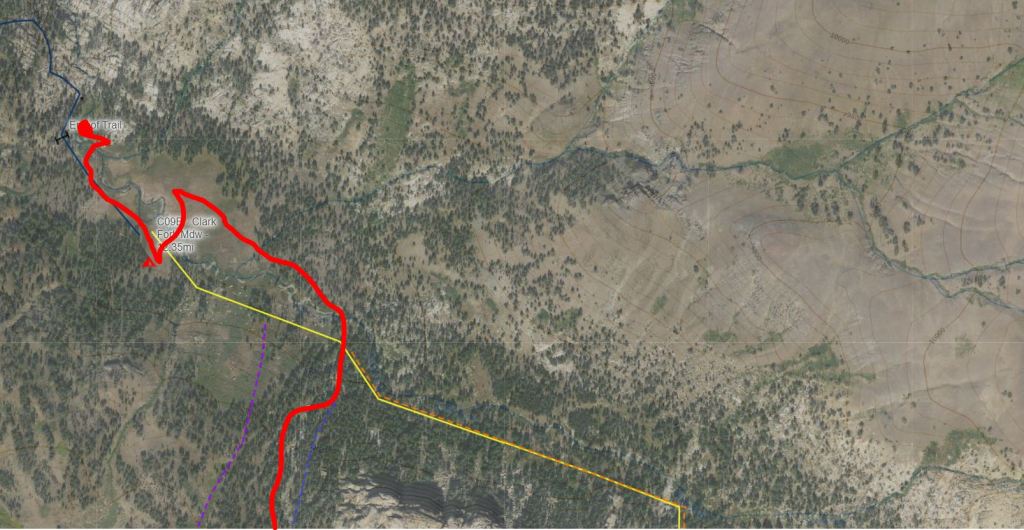
St. Mary’s Pass

The St. Mary’s Pass trailhead is literally just a few feet from Hwy 108 near Sonora Pass. The trail (which is labeled Stanislaus Peak Trail on some maps) begins with an 800′ uphill mile – then it’s time to turn left and head off trail for the remainder of the hike. There were several options at this point. The CalTopo GPS Route offered no less than three (or four if the yellow/orange routes were considered distinct). Upon arrival I could not see any major advantages to any of them, and they were relatively close to each other. I got as close to the blue “Winnet Route” as I could.

My goal from the trail turn off was just to get to the “Brown Mound” I had seen in the satellite image above (where the orange and yellow routes take a sharp 90 degree turn). It turned out to be fairly prominent so it was no problem crossing the canyon and climbing up to it. I then headed in a generally north-west direction through a small high desert area then to an overlook at the edge of the “bowl” where I stopped for a snack. From here I could see Clark Fork Meadow in the distance.

To my left was the rocky expanse I was supposed to arc around in order, I supposed, to avoid a bunch of scrambling. The same kind of rock lay in front of me and probably extended to the meadow itself. The yellow/orange “St. Mary’s Actual” route on CalTopo seemed to be what the guy at the old school Tahoe-to-Whitney website called the “up the middle” route. While more direct, it looked like it involved about 1,000′ of downclimbing a maze of rock. I could not see a route through the trees and had not started early enough to risk hiking time route finding. In any case, I was there to check out the various “Winnet Routes” and none of them went this way.
Routes Around the Rocks
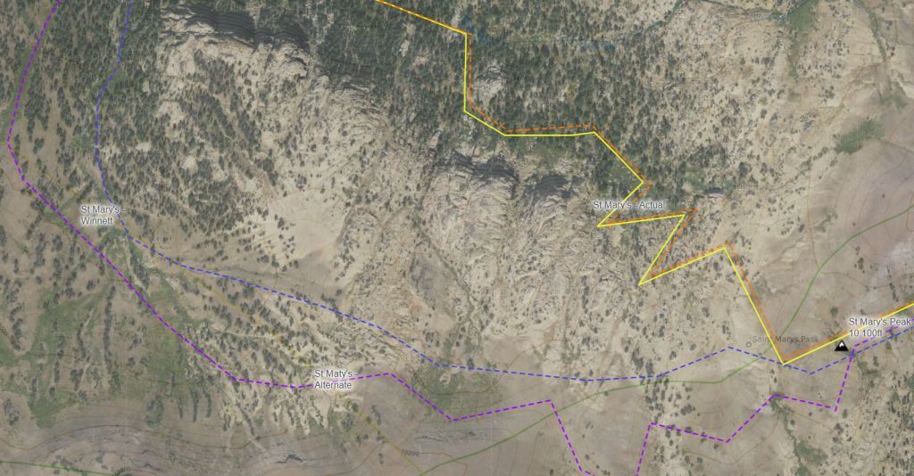
There were two prominent routes on the CalTopo GPS map called “St. Mary’s Winnet” (blue) and “St. Maty’s [sic] Alternate” (purple). At times they looked so close together it made me wonder why they were even seperated. I decided to stick to the blue route as it looked closest to Winnet’s original TYT and because it made sense to basically stay as close to the rocks as possible to save on distance while not having to lose time scrambling over all the mini canyons they created (as fun as that would be!).
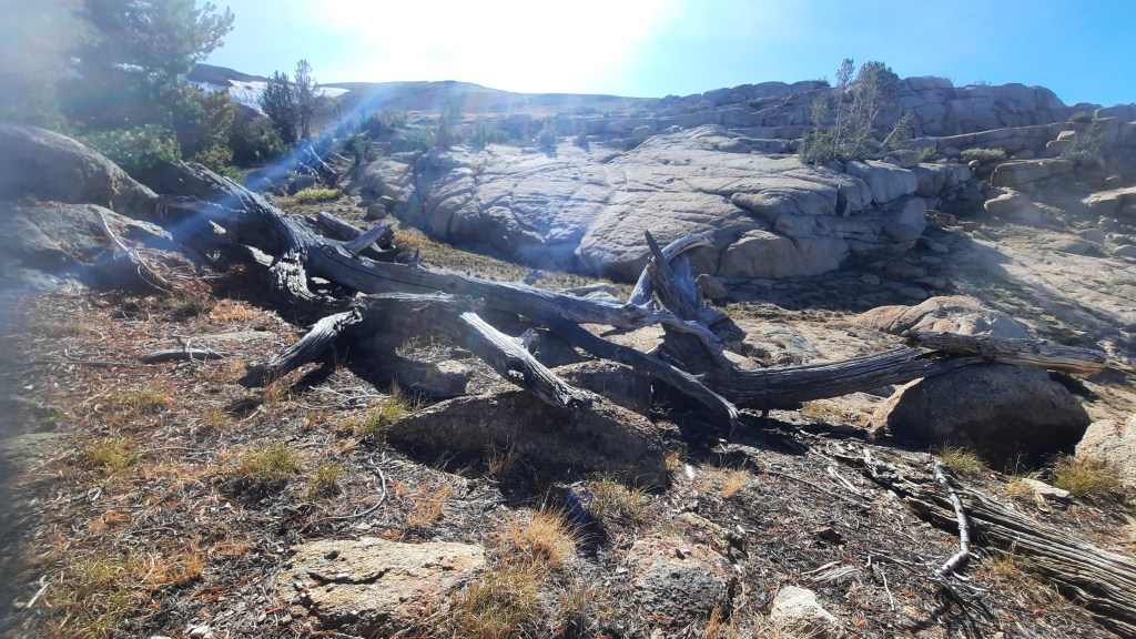
At this point I realized my first mistake in reading the satellite imagery: I thought the rocks were large structures above the route. They are actually the top of the bowl that contains Clark Fork Meadow. So this area is mostly rolling hills (you drop about 600′ in a mile) – next to the seven or so major rocky areas clumped together to form the bowl’s edge. They are beautiful and exploring them would be worth the hike by themselves.
I went back and forth from the route to the rocks numerous times because they were just too cool and the views at their edge were fantastic. I ended the 1-mile traverse in one of several steep creek canyons and eventually emerged into the forest where it was time to make the big northward turn toward Clark Fork Meadow. At this point I realized my second mistake….
Falling with Style
I could tell from the map that this turn was hemmed in by a creek which made navigation quite simple. What I missed was the elevation drop this seemingly small section involved. You drop about 600′ in half a mile. Not a big problem going down – but between route finding and carrying a backpack, coming back up it would be challenging!

There isn’t much to do but go down and try not to fall. The creek is worth keeping an eye on as it is quite beautiful. It’s very rocky so there are lots of little waterfalls and in places gives you a preview of the amazing canyon falls below the Meadow. I crossed the creek twice to avoid bushwhacking, but it wasn’t strictly necessary. I recommend crossing from the east to west banks when you reach the heavy bush, then continuing down the west slope as the creek expands into a seriously steep canyon. Once the creek crossings become manageable again, then either traverse down to the meadow or re-cross the creek once and head straight down to follow the more Winnet-like route.

Clark Fork Meadow
Here again Winnet’s routes differed. One had the hiker cross the creek that forms the southern edge of the Meadow and then head left up to its northern boundary. Another kept to the south side of the creek and not cross until you reached the northern edge. I crossed the creek figuring how much difference could there be?
Oops.

So the Meadow was fine, and I enjoyed hiking across it until I found myself in standing water. As it turns out, meadows at the bottom of giant mountain bowls tend to become lakes in record-snowfall years. (Who knew???) Clark Fork Meadow was no different and so I decided to cut across it to the south, re-cross the creek, and get up on the elevated edge to work my way around to the north end where some trees and rocks looked like a great place to make camp.
Camp
After yet another creek crossing I found myself high and dry and back in the dirt. Since this was a tarp camping trip I tried to find a flat spot between trees to support a ridge line. The whole are looked good but something kept me searching. I followed the sound of falls and discovered a perfect area with 2-3 camp spots right next to one of the greatest box canyon falls I’d ever seen.
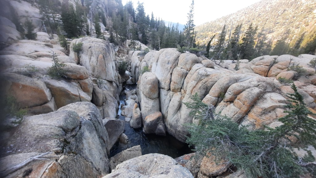
I was obviously not the first to stop here as I found campfire rings and remnants of old camp gear (which I cleaned up). Overall, though, it was pristine. I set up, made dinner, and kicked back at the top of a 30′ waterfall as the sun disappeared behind the soaring cliffs above me.
Not a bad end to the day!

The night was unremarkable – cool but not uncomfortable. it dropped below freezing because the creek was icing up when I awoke but there was not too much of a breeze down in this protected site so all I needed was my puffy jacket and hiking pants.
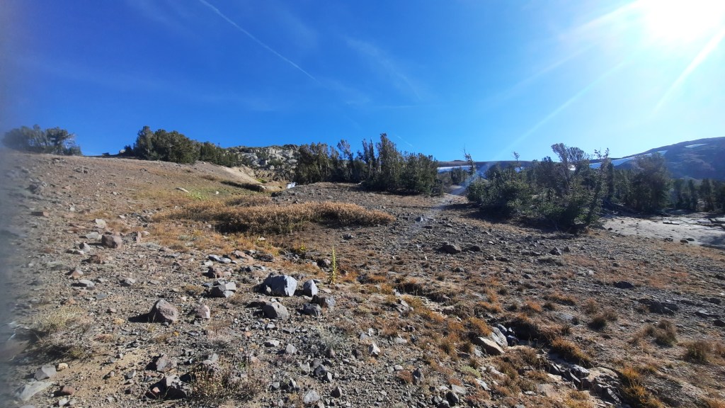
After breakfast I rock hopped over to the other side of the creek and headed down a bit to see if I could pick up the TYT route coming from the north. The canyon below the bowl drops off steeply following the creek among many rocky paths. I found enough ducks to be confident that the route was followable and once I had descended 100′ or so I turned around and followed it back up. After breaking camp I followed it to “Trail End” on the map where the trail simply faded away with no drama whatsoever.

A Challenging Hike Out
Since I had a total of three days off from work, I was not sure if I wanted to hang around or head home. I had accomplished all I wanted to on this trip and I am not much into solo camping, but I was still considering just taking the day off to poke around the area since it was so epically cool. About then, however, the sketchy clouds I had been watching for an hour turned even darker and the wind more continuous and colder. I had a strong sense that it was time to go, so I packed up while I could still do so in dry conditions and hit the “trail.”

I was now hiking what would be the last day of the section I planned to do after the Carson Pass-Lake Alpine hike I had skipped. Knowing the hill(s) that were ahead I decided to intentionally hike slowly and carefully. I stayed on the edge of the Meadow, passed the wonderful waterfall that marked the time to start looking for an upward route, and once I reached the creek that I would follow up to “The Turn” around the rocks I was up about 50′ above the Meadow. Rather than cross the creek here, I followed vague use trails and rare ducks up the northern slope until I got passed the “Seriously Steep Canyon” to the “Bushy Area,” then crossed to the southern side.

When I arrived at the beginning of “The Turn” I was greeted by a cold blast of wind carrying snow. I dropped my pack and got my trusty Frogg Toggs rain jacket on and put my rain kilt in my pocket for quick access should it come to that. I am a pretty hot hiker so the puffy coat would not come out unless I had to stop for a considerable amount of time.
To save time, I wanted to avoid climbing up the sandy canyons and scrambling up the rocks I had come down the day before. So I chose to take a wider arc around the rocks (possibly following the CalTopo purple “Alternate” route). This involved a lot of hilly climbing but nothing difficult or technical. I came out much closer to the snow-laden pass edge than I had come in on and I hiked up to the top of its lower shoulder just to see the view. It was nice, but it was also much colder and the wind/snow was not letting up so I put on the kilt and made for the area I thought of as “Domino Rocks” on my way in. I ended up walking right to them and this meant it was time to head over the pass and aim for Brown Mound.

Hike’s End
Long story short, the weather held steady which wasn’t too bad (I actually appreciated the cold as it kept me from swamping out under my jacket), and I retraced my incoming route pretty easily. Once I reached Brown Mound, I gave up the Winnet/Alternate/Actual routes entirely and just made straight for the lowest point on the trail that I could see from my vantage point. Either way, reaching the trail meant climbing down and then up the intervening canyon, so why bother climbing higher just to add more downhill?

I finally got to the trail and followed it down a mile while white dust accumulated across the ground cover. I completed the hike in just under 4 hours which surprised me as I thought I’d been hiking a lot slower. All in all, I was very glad to have become familiar with this area before hiking into it at the tail end of its section.
It is not to be feared, but it is to be respected.
