
TYT SECTION 4
My friend Greg joined me on the next section of the Tahoe-Yosemite Trail beginning at Lake Alpine and ending at Clark Fork Campground. We took the 3rd edition route past Duck Lake through the “Christmas Tree Farm” to Rock Lake, then did some serious route finding to Spicer Reservoir and then camped near Highland Creek on this two-day trip.
This section was pretty rough. There were so many fallen trees obliterating the (virtually non-existent) trail, and burnt sections were overgrown with miserable Snow Brush. Plus it was hot and about 4/5 of the water sources were dry. This is not a route for the casual backpacker.
“The Tahoe-Yosemite Trail: Where you don’t do miles, you find miles!”
DAY TEN

Lake Alpine to Rock Lake
We staged our hike at Clark Fork campground on August 20th so we could get an early start on the 3-hour drive it would take to get from the pickup location at the end of the Arnot Creek Trail to the trailhead at Silver Valley near Lake Alpine. Because we stopped for an excellent breakfast at the Pine Cone Cafe in Mi-Wuk Village, we didn’t get on trail until 10:45am. We didn’t think it would be a problem because we only had a 10-mile day planned and I had scouted it out from Lake Alpine to Rock Lake, and Greg had done much of the remainder two years ago.

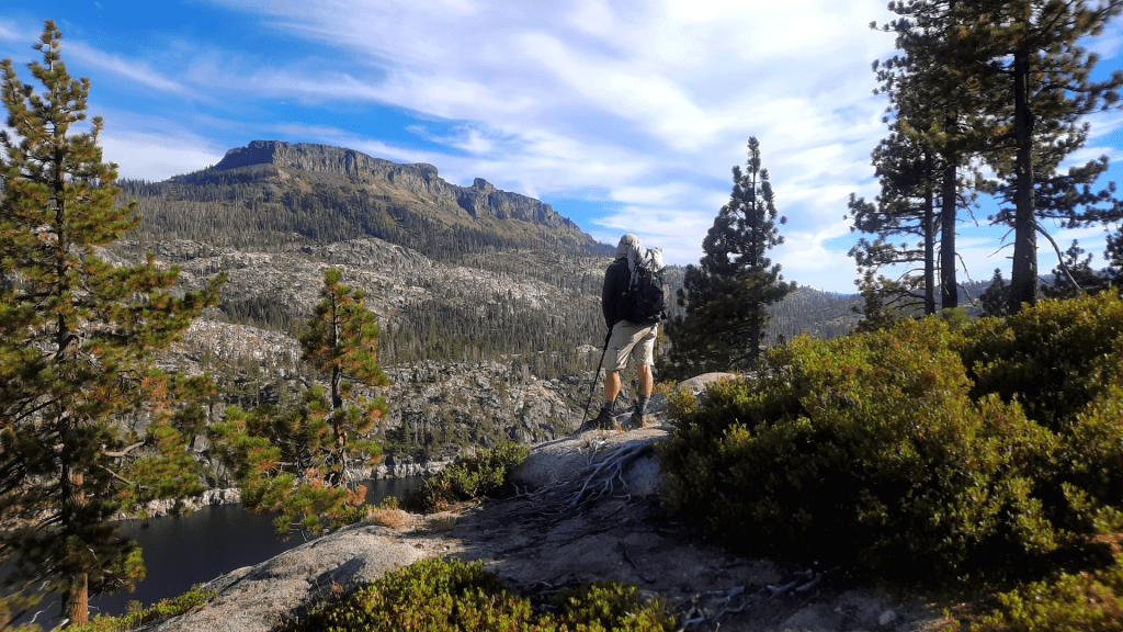
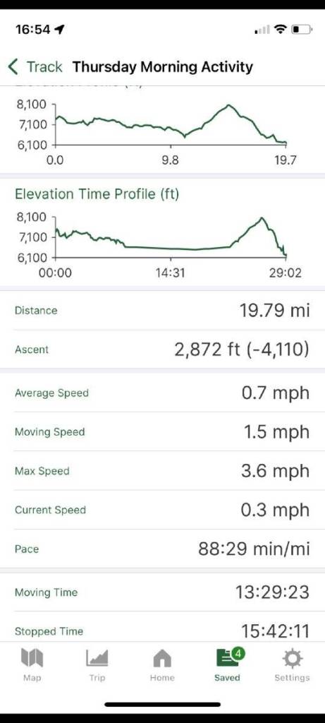
We made good time to Rock Lake by taking Winnett’s 3rd edition bypass trail around Duck Lake by 11:30, crossed the Stanislaus River at 12:00 noon, had lunch, and got to the “Christmas Tree Farm” at 1:00 (you can read the details about that route HERE as it has not noticeably changed). At 1:40 we were at Rock Lake, where we thought the rest of the route would be a cruisy 7 miles to Highland Creek because after the dreaded “Christmas Tree Farm” the hard part would be over!
We were wrong.
Rock Lake to Highland Creek
We took a break at Rock Lake and got back on trail at 2:15. I figured 3.5 hours to knock out the 7 miles that would bring us to the far eastern end of Spicer Reservoir (formerly Gabbot Meadow) where we planned to camp near highland Creek. Unfortunately, the route was festooned with downed trees which not only created obstacles that had to be worked around but also obliterated what meager vestiges of trail remained. In addition there were numerous burned areas with Snow Brush overgrowth so thick the route can barely be seen (long pants recommended!).

To put it mildly, Carson-Iceburg Wilderness trail maintenance leaves a lot to be desired. Although showing on maps as a legitimate trail, the Highland Creek Trail is a disaster from the Stanislaus River crossing to the ridge above Spicer Reservoir as well as parts of Jenkins Canyon.
It took us an hour just to cover 1.2 flat miles to the Summit Lake trail junction (which we never actually found), another 20 to get to Wilderness Creek (dead / dried out), and another 40 minutes to gain the ridge. This was all in pretty steady sun exposure too. We didn’t hit good shade until 5pm.

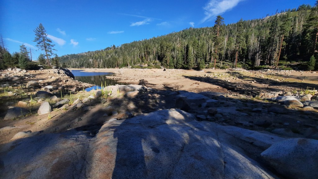
At 5:20 we were looking down into Spicer and across to the amazing Dardanelles Cone which we had been fixated upon since just after Rock Lake. 20 minutes later we could see to the eastern shore of the reservoir which was our goal for the day. Incredibly we needed 2 more hours to get there! It did not look that far but it turned out to be about 3 miles – much of it rolling up and down through dark forest (and a few running creeks!).
Somewhere along the route I kicked into the end of a stick that jammed into the ground when I tried to lift my foot over it, so I took a hard fall onto the trail. I wasn’t hurt but I did add several new scratches to my already red criss-crossed legs.
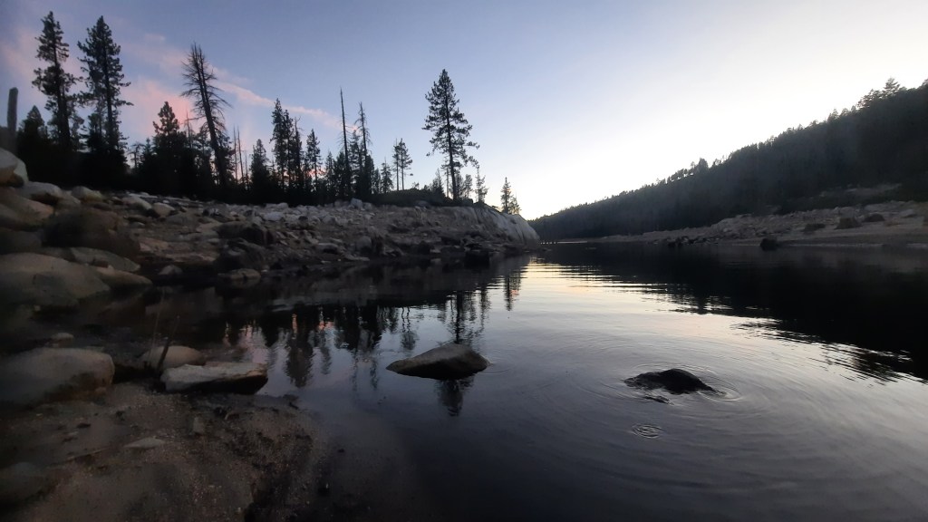
We got to within about 15 minutes of the highland Creek bridge and made camp down near the water on some nice flat areas. We cleaned off our dirt pants (filthy legs), made dinner, hung the bear bag, and collapsed in our tents.
DAY ELEVEN

Highland Creek to Arnot Creek
We slept soundly with on creature or snoring issues and by 8:30 we were ready to go. We reached the Highland Creek bridge 15 minutes later and found one side railing nearly gone. The trail once again faded in and out but we didn’t struggle too much as we had gotten our procedure down pretty well. One of us would lead and the other would basically buddy check the route the whole time. Someone could have probably tracked us just by listening for our shouts of “Trail!” and “Ducks!”

By 9:10 we came alongside Highland Creek – a gorgeous (get it? gorge?) rocky creek full of great swimming holes. We followed alongside its rushing waters and reached Jenkins Canyon around 9:30. Crossing Highland was no problem as it was fairly low, and form there we proceeded up the “gentle incline” to the top of the canyon in about half an hour. Soon after that we got to Jenkins Creek and then….around 11:15…. trouble started.
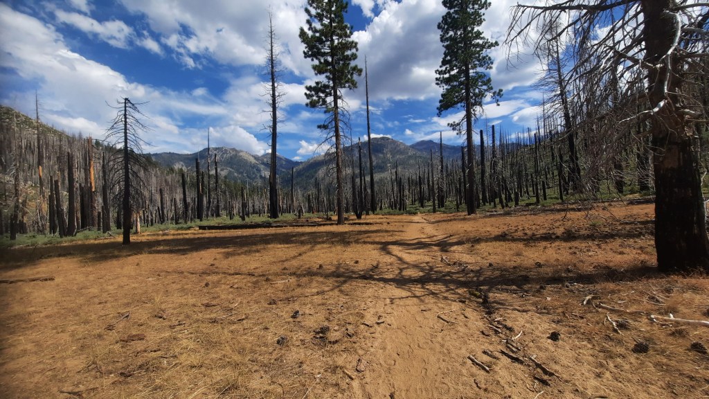
Shortly after one of the many tree fall obstacles, we found ourselves wondering where the trail went. For some time we just followed standard operating procedure and poked around trying to pick it up again but eventually we gave up and checked the GPS. We saw we were off trail – but rather than backtrack, we thought we’d just head up the hill and catch it above us.
That was not a good idea.

We ended up bushwhacking up a serious incline of about 600′. We constantly thought we had picked up the route only to check GPS and see that we didn’t seem to have hardly moved from our previous position. When Greg took a rolling fall that broke a trekking pole and lost a bottle, we stopped and collected ourselves. After a 15 minute break we were ready to go and split up (within eyesight) to get a high and low view of the landscape. We finally landed on trail around noon and reached the beautiful meadows at 12:45.

By 1:15 we were descending Wood’s Gulch. I discovered a blister had been growing on my right heel, and in the space of about 30 seconds it tore and i was limping badly. Got that fixed up and we were on our way. My Salomon boots fit so well that even with the blisters I could hike at full speed, so i think the problem was all the debris that got in over the past 15 miles or so (gators recommended!).
At about 2:50 we hit the switchbacks descending down to Arnot Creek trail and around 3:10 we got to what appeared to be a road on the map but turned out to just be a wide spot in the trail. This soon gave way to a very long, dry, hot, and scratchy final stretch to the Arnot Creek parking area which we reached at 3:50pm.
We got the obligatory selfie at the trailhead sign and began our journey back to lake Alpine to pick up the other car – but along the way way we hit up Pine Cone Cafe again for burgers.

Conclusion
This was one of the rougher sections of the TYT. Section 3 (Carson Pass to Lake Alpine) was difficult due to there being so much off trail route finding, the big river crossing, and the insane climb to Mt. Reba. I, however, was ready for all of that, having studied the route for nearly a year before going in. I wasn’t mentally prepared for the amount of work this section was going to throw at us, and that created a very different vibe as adventure gave way to frustration.
Further, because the landscape is so much more widespread, the lack of trail clarity was more taxing than in Summit City Canyon (which mostly involved following the creek down a narrow canyon). Although one could certainly navigate through this section using a map and compass, I don’t think there’s much chance of staying “on the TYT” without a GPS because even the mapped trails have largely disappeared. This section had far more ducks and blazes than Summit City, but with so many decisions to make in between them along the way, sticking to the “trail” can be even more difficult.
So be ready!
