
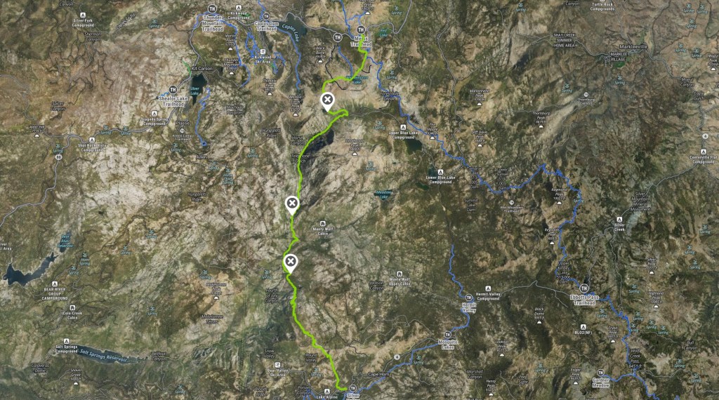

Section 3: Hwy 88 to Hwy 4
Finally getting to this section involved several challenges. Between record-breaking snow one year and a 4-month heatwave the next, it took me over a year to finally get back on the TYT. The weather was perfect (highs in the 60’s and lows predicted in the high 20’s but it never felt too cold to me). The “trail” here, however, is the most difficult of the entire TYT route…
Terrain
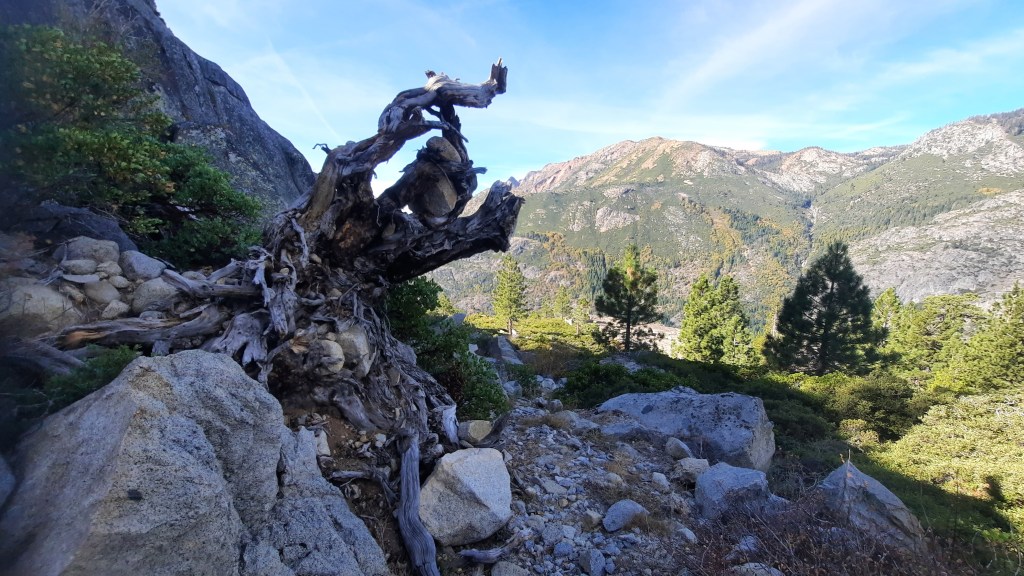
The TYT route was bypassed here instead of being absorbed into the PCT for a reason, and here it is certainly no hiker superhighway. It’s mostly unmaintained mileage covered in loose rock, downed trees, deep duff, and overgrowth of the hearty Sierra vegetative type. I counted at least half a dozen creek crossings and one major river crossing. This is not a place for mesh trail runners, shorty shorts, or much exposed flesh of any kind.
Route
First, much of the route is along unmaintained trail and the terrain is not always friendly to cross-country travel. Several warnings concerning this area are interspersed throughout the Tahoe-to-Whitney webpage, and the one guy I found who did the route in the last decade made a somewhat frightening video about his experience HERE.
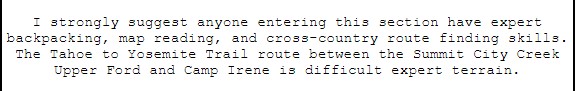
The “trail” through here has not been kept up for decades, and I had found no good info on it that wasn’t at least 10 years old (see the Tahoe-to-Whitney webpage). So I had no idea where the proper trail would end and the mere route would begin. GPS was often (but definitely not always) accurate as far as general direction, but in this area small mistakes can quickly lead to big ones. While not strictly necessary just to get from Point A to Point B, following the TYT “perfectly” is impossible because even in its heyday, the TYT was more of a cross country route here than a trail. It took Winnett’s book, maps, and two GPS apps working in combination to keep me on track.

Water
Being so late in the season, I was faced with two opposing issues: not enough water, or two much. The first day would be fine because I’d pass three major lakes, but after descending into Summit City Canyon from Fourth of July Lake, I had no way of knowing if Summit City Creek would be flowing. if it wasn’t I needed enough water for at least two days until I got to Camp Irene on the Mokelumne River my last night. That could mean adding a 14 pound water carry to my kit!
If there was plenty of water I would face numerous creek crossings and the major river crossing at Camp Irene. My initial plan was to camp on the west bank and cross in the morning so that if I got wet (a guarantee according to most sources), I’d be able to hike it off ascending Mt. Reba. However, now that I was hiking in the Fall instead of Summer, I had second thoughts.
Elevation
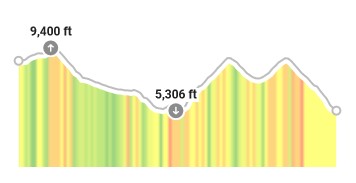
The final challenge would be the climb out of Summit City Canyon to the top of Mt. Reba: the lowest to highest points of the TYT. It would mean hiking up 3,600 feet in under 5 miles along unmaintained trails after three days of backpacking. After that, it should be an easy 3 mile descent to Lake Alpine along trail I had already (mostly) hiked in the past.
Trail Condition Summary
In case you just want a quick report on 2024 trail conditions, here are the bullet points:
- The trail was clear as day from Meiss/Carson Pass all the way to Fourth of July Lake as well as the traverse down into Summit City Canyon.
- Summit City Creek was running fine after a major rainstorm the week before.
- From the campsite near the SCC trail crossing where the (bear-ruined) 4×4 trail sign is, the route is decently follow-able with a trees down and few fade outs until the split between the Summit City Creek Trail and Camp Irene Trail.
- At the split I took Winnett’s eastern creek crossing route and lost the trail/ducks completely after about 5 minutes up top and had a nasty bush whacking ascent/descent from there back to the granite slopes on SCC where the two routes re-converge.
- The route up and over the granite to the major SCC crossing near the Mokelumne River is clearly marked by Manzanita pathways and ducks.
- The SCC is running but easy to cross on rocks. The route is on and off from there to the top of the granite and well into the so-called “Enchanted Forest.” If you get off trail head to the canyon wall and just cruise along it.
- The subsequent drop into Camp Irene is all about the ducks. Let them tell you how to get off the granite safely.
- The Mokelumne River was completely full. I had a hard time finding a good crossing point at Camp Irene as the “crossing logs” over the channel at the south end were submerged and blocked by an overhanging tree. I spent quite a bit of time up river looking for a rock-hopping route and finally gave up and made a few moves on to submerged rocks. I managed to make it without getting my calves wet though!
- After that it is very difficult to get up to MT. Reba. The “trail” alternates between invisible to completely overgrown (even on the clear granite parts the bush is so thick it’s a real chore to get through).
- After far more route finding than I expected in Lake Valley, I finally got on trail again, summited, and it was all clear (although not very well signed) from the pass just below the summit of Mt. Reba to the Bee Gulch trail into Lake Alpine.
DAY 1: Carson Pass to Fourth of July Lake (5.8 miles, 1,000′)
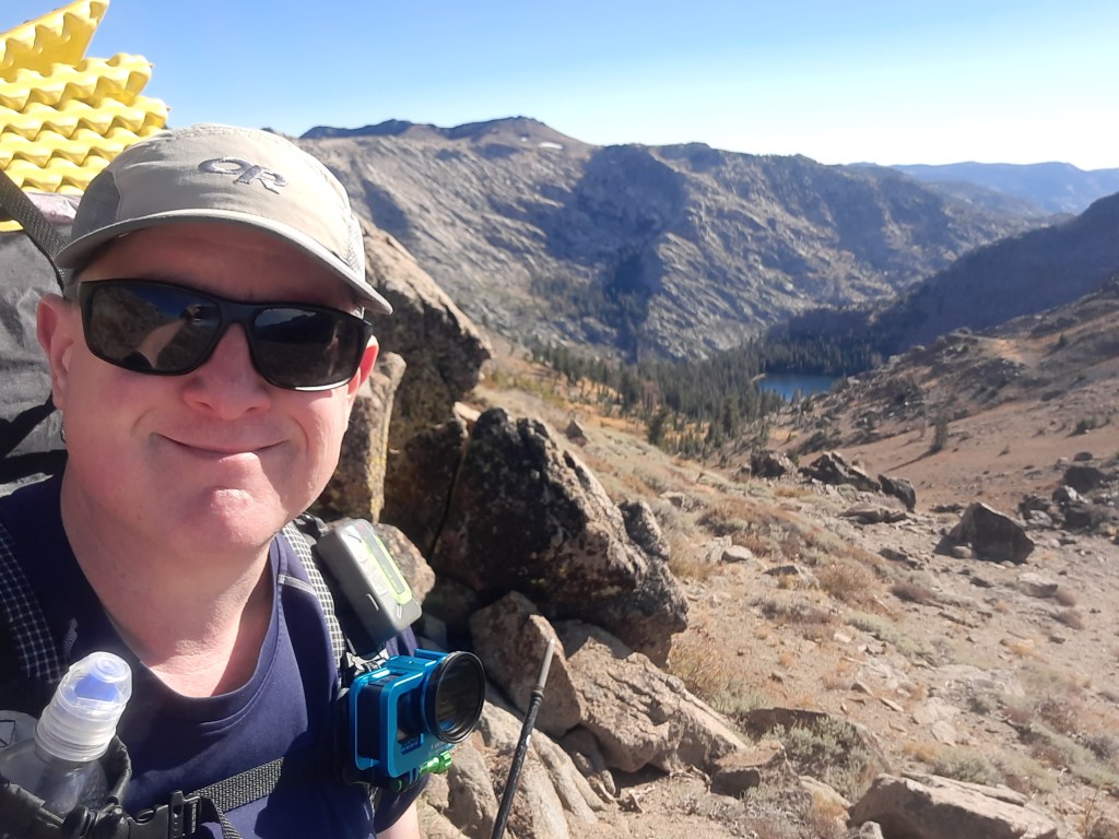
My mom dropped me at the Meiss parking lot where Dominion, Discord, and I ended out single-day, 16-mile hike from Echo Lake over a year ago. I geared up and we walked the short distance trail to Carson pass where we parted ways and I started what I expected to be a 4-day journey to Lake Alpine. For the first mile or so I would be hiking along the last remnants of the PCT before it turned East and the TYT proper began.
From the Pass to Frog Lake is about a mile and a half with a few hundred feet of elevation gain. Not far past it is the PCT turnoff that takes one north of Elephant Back (the quasi-half dome looming above the trail). Instead of taking this turnoff to the left, the TYT stays to the right toward Round Top peak (featured on the covers of second and third editions of Winnett’s book). At the bottom of Round Top lies beautiful Winnemucca Lake in about one mile.

I’d snowshoed this route up to Round Top Lake a few years before so I knew the area, but had never really seen either lake (not much of anything on the ground), so it was nice to see this beautiful (and popular) area in both seasons.
After crossing the outlet stream at Winnemucca’s west shore, the TYT turns west and heads uphill (400′) in a mile to the crossing of Roundtop Lake Trail at (you guessed it) Round Top Lake. I had a cool encounter with another hiker who recognized me from my Backcountry Pilgrim YouTube channel, and she also knew enough about the TYT to be excited that I was trying to re-hike it. That was fun!

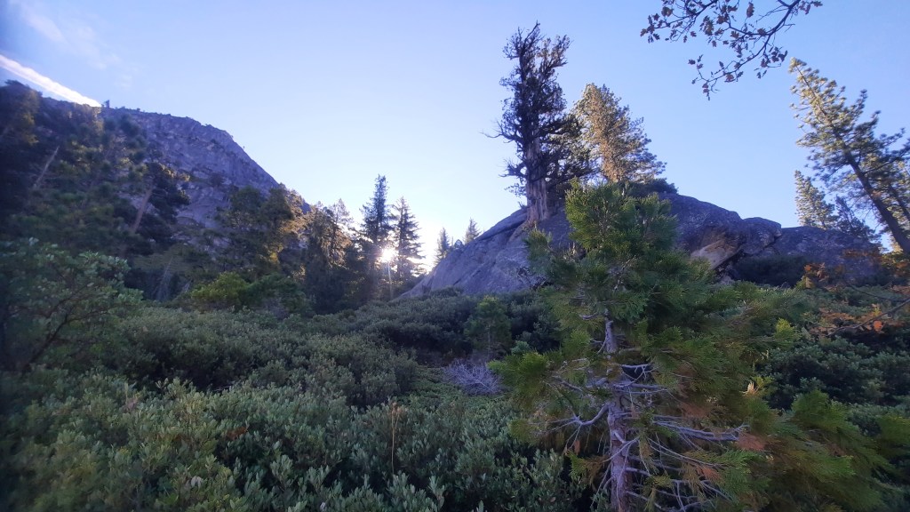
From here the TYT wraps itself around the base of some small peaks on the western slope of Round Top called The Sisters. At this point the climbing is basically over and the trail cruises downhill all the way to the bottom of Summit City Canyon. That was my goal for the day – but for reasons I’ll explain below, it would soon change.
In a little under a mile after beginning its downhill ride from Round Top Lake, the TYT stays to the left at a jumble of rocks instead of taking the right fork to Fourth of July Peak. It then proceeds to drop 1,000′ in 1.5 miles down to Fourth of July Lake which you can see much of the descent of an incredible rocky valley between The Sisters and Fourth of July Peak. From this altitude you can also see over the edge of the bowl containing Fourth of July Lake into Summit City Canyon itself.
Once I finally leveled out, I found myself at the eastern side of Fourth of July Lake. As of 2024, the 4×4 trail sign there also includes a tip of the hat to the TYT! Turning right here took me past some campsites to the water. The lake is a beautiful place but it requires a permit to camp, and there is a good possibility of people due to the easy access and fantastic lakeside campsites. When I arrived there was no one there.
I knew that if Summit City Creek wasn’t running, this would be my last water until the Mokelumne River at Camp Irene. It had been a dry year with a four-month heatwave so i was not optimistic. However, there had been one significant rain the week before so it was not impossible that I’d have water. My plan had been to camel up and add 8 liters worth of water storage (over 15 pounds!) to my pack, then hike the final mile down into Summit City Canyon and go as far as I could by nightfall before camping. Now I rethought that plan.

Originally I had figured a full day of hiking the first day to get as close to trail end as possible so I could hopefully make it to Camp Irene the following night. However, I had given myself four days for this trip to avoid feeling rushed and not really gotten on trail until well after 11am so the sun was already behind the peak. it was only about 5pm, so I could still make it to the canyon before full dark (which at this time of year was between 6 and 6:30pm), but I realized that I could effectively add two meals (dinner and breakfast) and one night’s worth of water to my carry by by staying overnight here and refilling in the morning before heading down into the canyon. So that’s what I did.
I found a good spot away from the established campsites just in case anyone showed up (no one did), and set up my tent. For my fellow gearheads: I went with my ultralight Durston Gear X-mid trekking pole tent and a 10-degree Zenbivy UL Bed with an additional Therm-A-Rest Z-Lite foam pad that I used for a variety of things until I lost it. (More on that later.) After hanging the bear bag (Hilltop Packs, of course – same as my amazing custom Raven backpack), I laid around until sleep took me some time later.
 |  |
Day 2: Trail Merge (7 miles, 280′)
I woke up with the sun and took my time getting ready. I restocked my water, lugged my (now) 40 pound pack on, and headed back to where the trail headed downhill into Summit City Canyon. The route down is somewhat annoying as it actually traverses 745 feet down but a mile north up the canyon rather than south – the direction I was to be going. So it goes.
The hike down was pretty spectacular and it was a genuine thrill to finally see the legendary canyon in all its glory as the sun barely peeked above the far side. It was a very rocky walk but the trail is obvious and I moved pretty fast. So fast, in fact, that I somehow lost one of my river crossing Crocs. I did not discover this until much later, and by then it was too late to recover. If anyone finds a tie-dye Croc, I apologize and I’ll reward you for packing it out.

I also saw quite a bit of bear poop – which brings me to my next stop. At the canyon bottom is another 4×4 signpost – newish like the one at Fourth of July Lake. I know the guy who helped install it with an NFS ranger. In his words, “there is a bear in the canyon that either really loves or hates 4×4 trail signs.” I can verify.
The post indicates the direction of the already-fading trail to Camp Irene but before I followed, I kept heading east straight a few yards to a lone campsite and then a little past that to Summit City Creek. It was running! I thankfully dumped about half of my water and got my pack weight back down into the 20’s. Then I walked back to the post, turned left (south) and began my journey down Summit City Canyon to continue on what some maps call the “Camp Irene Trail” (as opposed to turning north where it is then called the Summit City Trail – not to be confused with the Summit City Creek Trail farther down the canyon – before the Summit City Trail forks into the Evergreen Trail…)

I was disconcerted at first at how fast the TYT faded out but it turned out to be because it is simply sandy here for a while. I did not have trouble picking it out until I came to a massive series of fallen trees which obliterated the path only a few minutes later. Telling myself this is what I asked for, I began dealing with the debris field and logs when I noticed an old electrical insulator half buried in the dirt along with some wire. Was this part of Summit City itself? I grudgingly left this cool souvenir behind.
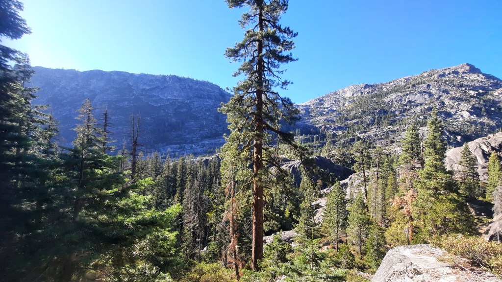
After the initial fade out and tree fall, the trail was much easier to follow and I made surprisingly good time along the beautiful Summit City Creek. The canyon floor remained fairly dense forest with the occasional view of towering canyon walls peeking between gaps in the trees. It was about 2.5 pleasant downhill miles (a 575′ elevation loss) to Horse Canyon, and I made it there faster than I had hoped. Here I found the third of the 4×4 trail posts, almost completely obliterated by the Canyon Bear. I could only read one side, but I found a large splinter indicating Camp Irene and placed it on the correct side in case anyone used this post to navigate.
Telephone Gulch was the next marked location on the map but I had no idea how to tell when I arrived. I just knew it was about a mile away and 150 or so feet lower. To be honest, even after looking at satellite images after the hike, I still am not sure what I was supposed to be looking for – it was sure pretty though! I had an excellent stop along the way just above some deep cataract bowls and a small waterfall in the creek. There were a couple campsites nearby with yellow “No Fire” flags planted in them.
One and a half miles and nearly 200 feet lower I would come to a trail split. The right fork was called the Summit City Creek Trail while the left fork (which meant a creek crossing to the eastern side) was called the Camp Irene Trail. After consulting Winnett’s book, I became convinced that the latter was the TYT proper.
Although barely over a mile, this segment (with an elevation gain of about 700′ and a 300′ drop) proved to be one of the most difficult. It begins with a simple rock hop creek crossing but then immediately scrambles up 40-50 feet (Winnett estimated 30) and then parallels the creek which you cannot see behind a large knoll (look for the Jeffrey Pine on top). The route here is decently ducked and keeps climbing. I eventually lost the ducks and at almost the exact halfway point between the trail split and where it rejoins, I came to the end of the granite and faced a steep hillside with no discernible path through it. The GPS said to climb the last bit of rock but that made no sense to me – but neither did bushwhacking through impassible overgrowth below the rock. I was stuck.
After probing around I finally gave up and climbed along the bottom of the rock outcropping and simply kept climbing up the loamy dirt. I variously climbed too high and too low, but here the route is meaningless and I just wanted to get down. In the end I ascended about 130 feet and then, finally, down 230 feet to a welcome granite slab for a break from the ankle-breaking 60-degree slope. Another 300 feet of off trail paralleling the creek brought me to a large slab that sloped down to water. This is where, according to the map, the trail split comes back together.
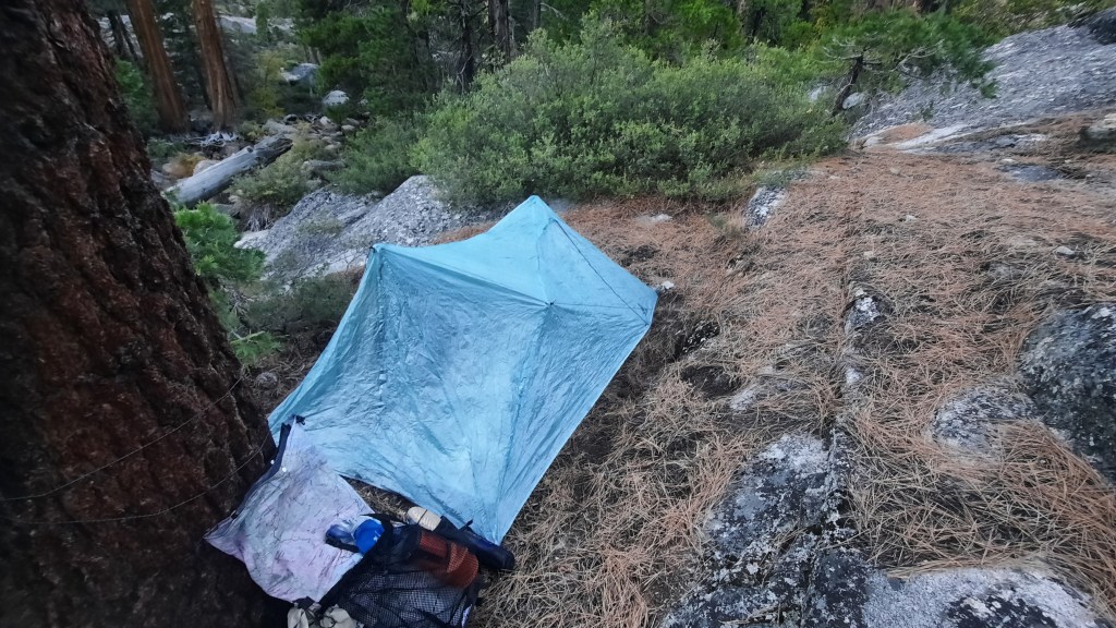
I managed to find the back trail closer to the creek but there wasn’t enough daylight left to explore much so I decided to make camp. Even with my one-person tent there not a lot of options as the ground was both sloped and rocky. I found one patch of level dirt in a small granite bowl requiring some creating staking techniques to pitch. (I’d recommend going with a fully freestanding tent to avoid this problem.) Made dinner, hung the bear bag, and was in bed not long after dark.
Day 3: Camp Irene (3.3 miles, 425′)
A mere 3-mile day sounds ludicrous, even to me – but a lot went into getting from camp to the other side of the Mokelumne River (yes, I crossed it today).
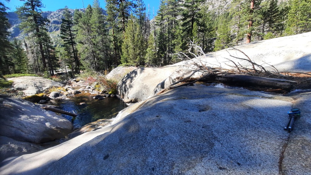
The first part of the journey today was just excellent in every way. Ascending the slab brought me to a seemingly curated trail through Manzanita and ducks were everywhere. The top of the granite sits above some beautiful cataracts so I had my morning coffee leaning against a boulder and just enjoying the view. From here the trail descends 700 feet in a mile to the final crossing of Summit City Creek just east of where it flows into the Mokelumne River. It’s not a difficult route to follow, especially if you don’t allow yourself to get distracted by the many dramatic edge views available off side trails along the route. (I definitely allowed myself these distractions!)
 |  |
The creek crossing was uneventful, there are numerous places to make it as the creek widens out quite a bit after making its eastward turn toward the river. Once across, I was looking up a 20-30 foot embankment and after spending ten minutes or so trying to find “the” way up, I just picked a decently clear route and scrambled up. I located the ducked trail and followed it back to where I was supposed to ascend (it’s near a fallen tree – like that helps).
Once on top, the trail skews westward over the rock until coming to the entrance (and it actually looks like one) of what the Tahoe-to-Whitney guy called “The Enchanted Forest,” but which my friend Greg called the “UN-enchanted Forest” due to its difficulty. According to the map, it’s about a 3/4 mile stretch of old growth forest between the canyon wall and the north fork of the Mokelumne River. I found it delightful and easy to navigate (other than one significant fallen tree) if i kept the canyon wall in sight. That is, until it was time to exit.

The end of the “Enchanted Forest” is the beginning of the climb up and around the west side of a massive rock outcropping that forms (on its east side) a canyon that the Mokelumne River follows before forming the pool at Camp Irene. (On the map it looks far more difficult to follow the TYT up and around this rock instead of just walking down the river canyon, but its walls are quite steep.) I had a very hard time finding my way out of the forest on to the route ascending out of it. It is densely overgrown (understatement) and several dry creek routes provided misleading routes up to the route.
After running out a couple of these I gave up and just went as close to the GPS route as i could and finally managed to get up on the rock and find some ducks. Like much of the TYT through this section, it’s more about getting from Point A to Point B than staying on a trail. From the exit of the forest to Camp Irene is a one mile half loop that rises about 230 feet before crisscrossing the top of the rock and following the duck-marked switchbacks down about 420 feet to the Mokelumne River and, finally, Camp Irene.
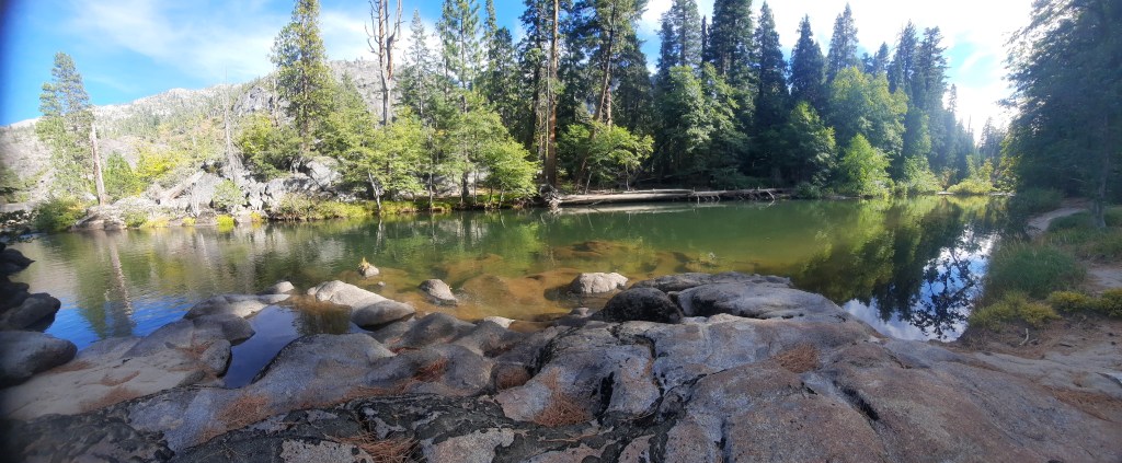
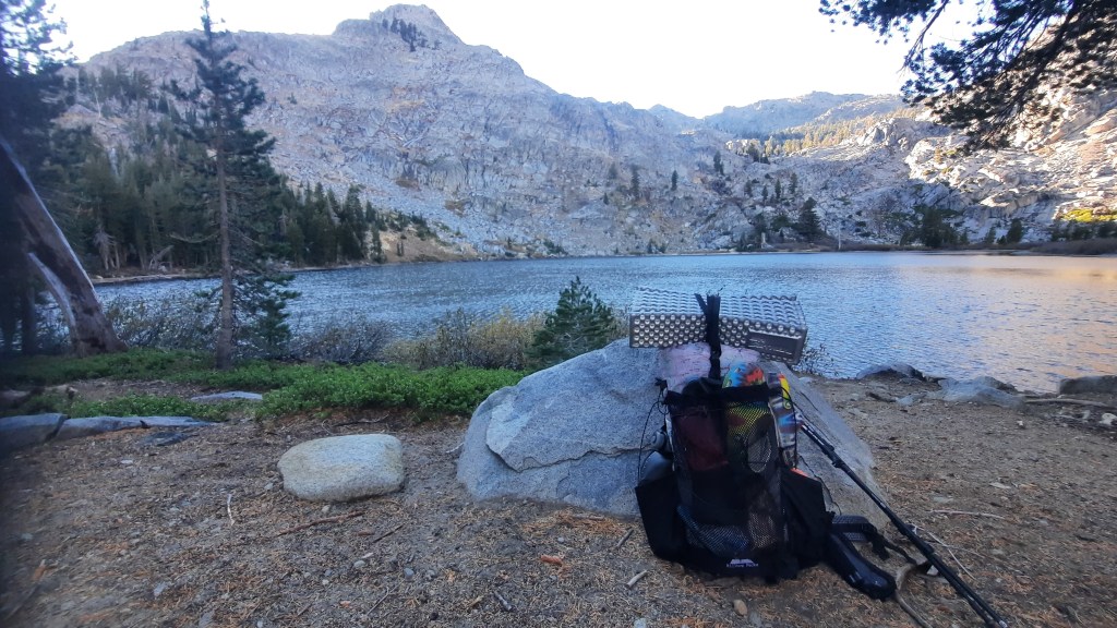
Camp Irene River Crossing
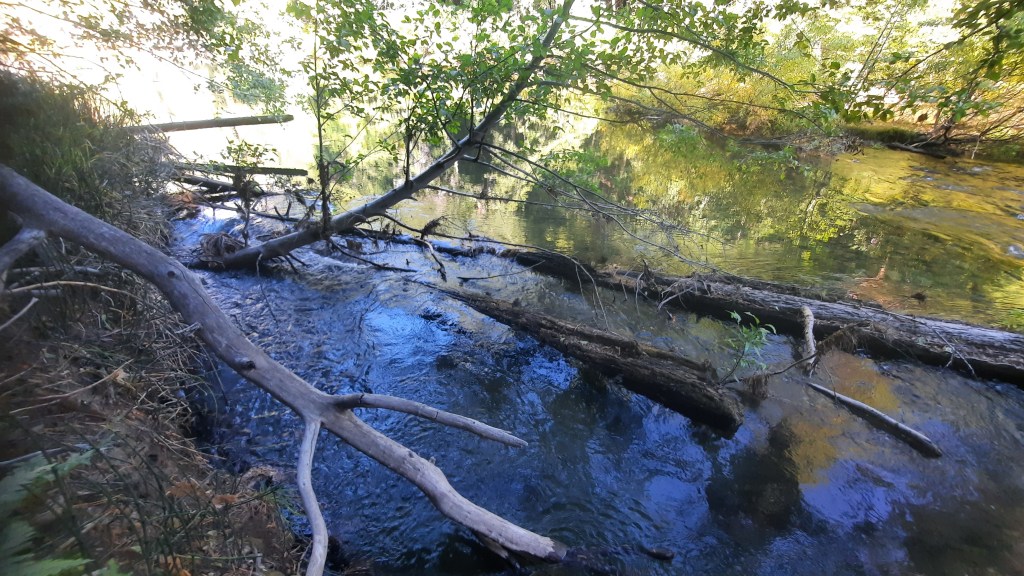
Camp Irene is a stellar campsite complete with an old trail sign, large fallen tree, fire ring, log benches, and even…a sandy beach! Between the site’s northern and southern ends, the Mokelumne River forms a beautiful deep pool with a shallow line of “rapids” interrupted by a small bushy island in the river’s center. This would be the obvious place to cross except that, first, the bank drops several feet into the water on this side into a deep channel that separates the bank from the rapid line. There was (still!) a fallen log that led from the bank to the rapid line, but not only was it nearly under water, a tree leans out over it making passage nearly impossible. Although this has been described as a chest-deep crossing, I wasn’t taking the risk with a backpack and facing an overnight that could drop into the 20’s.
I say “overnight” because I had decided that in the cold it would be less risky to get wet during the day so that I could get warm and dry my gear out (a bit) over night. Worst case, I’d be damp in the morning – which would be better than being soaked. So, instead of camping at Irene like I’d always imagined, I started probing the northern river bank for a way across.
Now for years I’d been obsessing over this river crossing. I had read every writing, examined every map, and inspected every satellite image I could find. In the end – although no one had ever even suggested it – I was pretty confident that crossing on the northern end was the better way. (Unless it was Summer and getting wet would be welcome!)
The northern side of the “pool” was quite wide and littered with rocks poking up out of the water. decades of rock hopping made me optimistic about finding a route across that would not involve the likelihood of taking a swim with my gear. As it was only mid-afternoon, I had some food before heading upriver to have a look, but when I did my optimism began to wane.
Although there were dozens of good-looking routes, every one of them ran out at some point. There was always a gap that was too wide to jump, a rock too far submerged to trust, a rapid too fast to risk… What I thought would be a few-minute scouting trip turned out to be an hour of scrambling up and down the rocky edge of the river. The sun was beginning to descend behind the top of the canyon, and I was getting a bit desperate.
I finally had to conclude that the best way across might not be a good way across and that regardless of the outcome, I really needed to cross before nightfall. I changed out of my clothes into (just) my rain suit and boots. All the clothes and down layers I’d need to survive after a plunge were wrapped in a compactor bag deep inside my already water resistant backpack. It was the best I could do.

It worked! The route went as I had planned until the one move I could not see from the (now) far shore. I was on top of a tall rock – the second to the last I needed before safety. Below me was the swirling river and two submerged rocks with heavy water flow across the top of them. I would need to use one or the other to vault across to the final rocks and shore. Reaching one involved a bit of a slide down and with a pack on that wasn’t a good idea. The other meant making a fast two-step move off the top of a very smooth looking round-top rock below me and under water. It was not something I would normally prefer to do but there was nothing for it so I just stepped out and hoped I would not slip off into the river. The boots stuck, the vault worked, and I was standing on dry rock! After several victory shouts and thanks to God, I edged around the bank to the far shore across from Camp Irene with nothing more than wet calves.
I headed south and east to find a campsite and found one ready made about 150 yards from the crossing (just south of a huge dry creek wash across from a downed log) and set up for the night. It had been a very low-mileage day, but it sure didn’t feel like it!
Day 4: Lake Alpine (7.8 miles, 3,600′)
After the successful river crossing I felt like the main challenges of the trip were largely over. I had plenty of available water (the Mokelumne is the last trustworthy water until Lake Alpine, so I carried 3 liters). My pack was as light as it would get on this trip (notably, I had lost my Z-Fold sleep pad during one of my bushwhacking sections – I was so mad). Finally, although there was some more off-trail on this side of the river and I was looking at climbing up 3,600 feet in less than 5 miles, much of the route up to Mt. Reba was supposed to be an actual trail. So my problems were over, right?
As you can probably guess, the answer was no.
Right away I ran into time-wasting trouble with the route. I felt surrounded by rock that I did not think I was supposed to climb and ended up back at my campsite trying to find a way through. I finally took a short climb up and over the rock closest to the river and found some ducks that wound around a turn that followed the river route. From here it was mostly just climbing up through steep forest and trying to find any sign of trail.

After the turn away from the river it’s about a 3/4 mile and a 500 ascent up through some of the toughest route-finding I experienced. I kept finding myself on steep slopes in thick forests of trees and / or thick Manzanita that seemed set on forcing me off route. Above a smallish valley I saw a bear! He was already running away from me before I could greet him with “Hey bear!” and access my spray. (Oddly this was only my second significant wildlife sighting after the chipmunk at Fourth of July Lake.)
I eventually emerged form the overgrowth and exhausting uphill route finding on to the last significant piece of granite of the trip. Guessing I would be climbing up this for many hours – and swearing to myself that I would never complain about a route again if I could just see the trail – I started up the granite switchbacks that begin the final 4 mile, 3,100′ ascent to Mt. Reba. Now, even in Winnett’s day these switchbacks were fairly notorious – they just go on and on and on and on and on. Today, however, they are also nearly completely overgrown with Manzanita and other vegetation making for a trail that would be difficult if it were flat. At 1,000’/mile, however, they are a serious strain.
There is about 1.5 miles of granite switchbacks offering little in the way of a break but some of the best canyon views of the entire hike. You can see all the way back to the descent from Fourth of July Lake and because the route goes downhill, you can actually see most of it from this higher southern elevation. There are many interesting rock formations as well, and overall it’s a gorgeous portion of the route even as it is the most exhausting. “At least I can see the trail!” I kept telling myself. That is, until I neared Lake Valley.
The last 2.5 miles is a 1,750′ climb through dense-to-sparse forest and even more off trail. Being closer to the established trail system past the Mt. Reba pass, there were more use trails to throw me off, and often the real route faded away across granite slopes. Everything was climbing, every mistake meant significant struggle. I felt absolutely blasted and fairly collapsed more than once into a heap on the trail just to get a break. I marveled at how long I had been hiking and yet I still had so far to go! Food fantasies and the promise of seeing my family that afternoon kept me going, but it was one of the most difficult hikes I’d ever endured.
I finally reached the edge of the bowl beneath Mt. Reba’s summit and was greeted by what looked like a gigantic barrier wall. I picked up the trail again though, and in just over a mile and another 800 feet, I stood on the dirt road that tops the pass below Mt. Reba’s summit.

Then….incredibly…I began to hike downhill!
The dirt road led to a couple trail crossings that were not very well signed. I knew I wanted Bee Gulch but the second trail fork had a sign was blank. Fortunately I knew to take the left here which immediately begins a steep downhill. The last 3 miles of the route were in front of me and I barely even noticed the distance. I was going downhill (1,400 feet) on a well-trodden trail and that was all that mattered.

I soon reached the cool rock feature off to my left that I’d hiked to a few times from Lake Alpine and knew it was just a day hike from here! The trail looks like it’s recovering from damage and/or forest work but it was still easy to follow. I got to the TYT sign near the route’s exit on Highway 4 and shortly after that followed the cabin route to more quickly reach the lodge where I was to be picked up. When I arrived I saw that it was under some serious reconstructive work so I just sat in a maintenance cart for a few hours before seeing the blessed headlights of the family minivan and my beautiful wife, daughter, and youngest son.
I had made it. The third section of the Tahoe-Yosemite Trail was complete.

