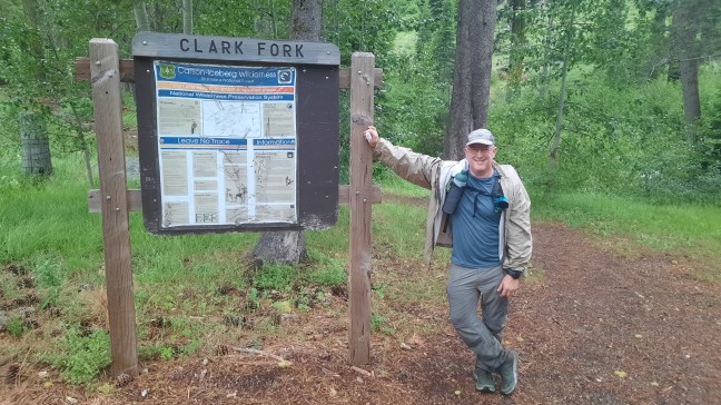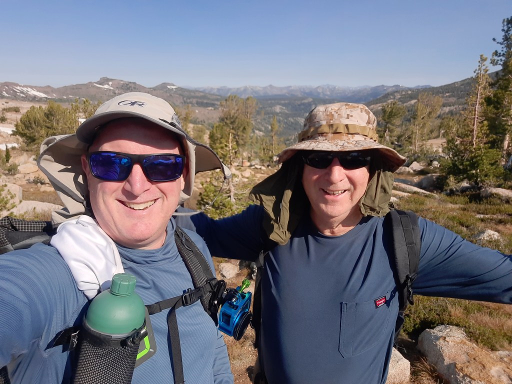
Having previously connected the Arnot Creek and Clark Fork trailheads with my kiddos as well as a recon hike a couple tears back from Saint Mary’s Pass into Clark Fork meadow, it was time to finish Section 5 with my buddy Greg. For Greg, this would be the end of his 52-year goal to complete the Tahoe-Yosemite Trail.
We camped at Kennedy meadows and hung out with PCT hikers then hit the trial after an epic breakfast at the Pack Station’s restaurant. Due to the hot temps and potential water carry issues, we had decided to do this section NOBO which would make the majority of this off-trail route downhill, toward water, and gradually increasing trail quality. When i mapped it out, it appeared we could do this as a light-pack day hike instead of a 2-day backpacking trip. Once we experienced the route, we were both very glad we did!
The beginning of the hike went exactly as expected – a short, steep climb up near Saint Mary’s Pass then west across the top of the bowl of Clark Fork Meadow. As tempting as some scrambling was, we mostly avoided the rocks to keep us moving. After some fun glisading down one of the final chutes into the forest we headed north and down the unmarked slope into Clark Fork Meadow.
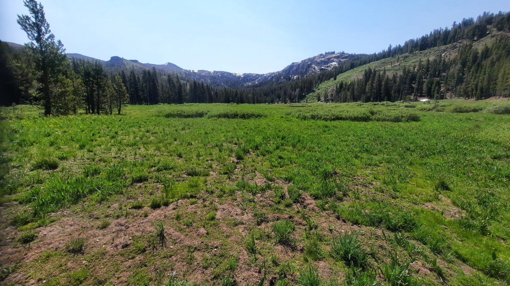
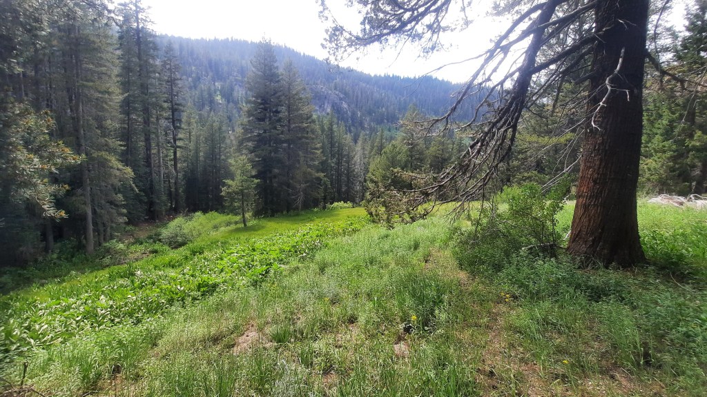
The Meadow was beautiful – green and lush. There was a lot of snow melt runoff making the ground extremely muddy and sticky. not wanting to lose our shoes, we opted to walk down the headwaters of the Stanislaus River which here is only about 6 inches deep. Cool and refreshing! At the western edge of the meadow we found my old campsite and took a nice break for lunch. This part of the hike took us 3 hours.
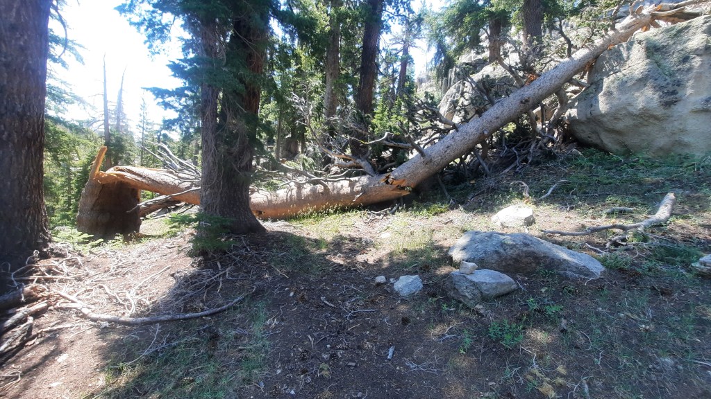
The segment of this section that concerned me most was next. The drop into Clark Fork Canyon was reported to be quite a challenge both for route finding and terrain. There were definitely some sketchy parts such as steep traverses where the integrity of the soil required a leap of faith. All in all, it wasn’t bad – still well-ducked at the beginning but these largely disappeared for quite a while. Downed trees obscured or obliterated much of the “route”trail.” But after about an hour we reached the ford of the river (once again shallow enough to be of no concern).
Having previously connected the Arnot Creek and Clark Fork trailheads with my kiddos as well as a recon hike a couple tears back from Saint Mary’s Pass into Clark Fork meadow, it was time to finish Section 5 with my buddy Greg. For Greg, this would be the end of his 52-year goal to complete the Tahoe-Yosemite Trail.
We camped at Kennedy meadows and hung out with PCT hikers then hit the trial after an epic breakfast at the Pack Station’s restaurant. Due to the hot temps and potential water carry issues, we had decided to do this section NOBO which would make the majority of this off-trail route downhill, toward water, and gradually increasing trail quality. When i mapped it out, it appeared we could do this as a light-pack day hike instead of a 2-day backpacking trip. Once we experienced the route, we were both very glad we did!
The beginning of the hike went exactly as expected – a short, steep climb up near Saint Mary’s Pass then west across the top of the bowl of Clark Fork Meadow. As tempting as some scrambling was, we mostly avoided the rocks to keep us moving. After some fun glissading down one of the final chutes into the forest we headed north and down the unmarked slope into Clark Fork Meadow.
The Meadow was beautiful – green and lush. There was a lot of snow melt runoff making the ground extremely muddy and sticky. not wanting to lose our shoes, we opted to walk down the headwaters of the Stanislaus River which here is only about 6 inches deep. Cool and refreshing! At the western edge of the meadow we found my old campsite and took a nice break for lunch. This part of the hike took us 3 hours.
The segment of this section that concerned me most was next. The drop into Clark Fork Canyon was reported to be quite a challenge both for route finding and terrain. There were definitely some sketchy parts such as steep traverses where the integrity of the soil required a leap of faith. All in all, it wasn’t bad – still well-ducked at the beginning but these largely disappeared for quite a while. Downed trees obscured or obliterated much of the “route”trail.” But after about an hour we reached the ford of the river (once again shallow enough to be of no concern).
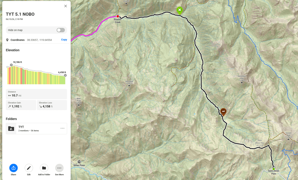
Just across the river were two blazed trees forming a sort of gateway into the next segment – approximately 7 miles to the trailhead. We had hoped at this point to find faint trail bed (which we did) and see a constantly improving route as we got closer to the maintained portion of Clark Fork Trail (which we did not – at first).
Instead we entered into one of the more difficult portions of the entire TYT. not only did the trail completely disappear, but the route took us much higher up the canyon walls than we expected for long traverses far from the water and easy navigation. For hours we basically stared at our GPS to stay on route, often crashing straight through heavy vegetation and numerous creek crossings. After nearly exhausting ourselves we finally decided we were heading down to the valley floor whether we were on route or not. I went my my gut while Greg let me know what the GPS said and incredibly we stayed pretty true to the satellite. Finally, just as we started to level out, we came upon a duck!
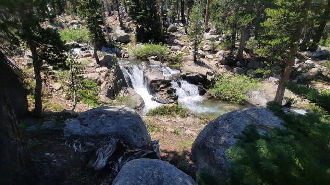
The duck was just east of the Seven Pines Trail junction which meets the TYT across the river at a small campfire ring. Joy of joys, there was trail here! On we went keeping close to the river with its many gorgeous waterfalls. We felt like we were on a high speed interstate freeway compared to the previous few hours. The miles melted away as we cruised happily along actual trail, passing the “100 Mile” mark at Boulder Creek trail.
The rest of the hike would have been rather uneventful had I not sliced my thumb open on my neck knife that I had hung from a side strap in an attempt to keep it from banging against gear on my shoulder strap. I had reached back to the pocket to change my GoPro battery and somehow managed to pop the sheath off the knife and slide my thumb down the blade, neatly filleting the tip of my thumb. Blood everywhere until Greg patched me up and I held the golf ball sized bandage wad the remaining couple miles to Iceberg Meadow.
After another surprise elevation change we finally dropped down to the river for the last time and spied the mighty granite fortress known as The Iceberg to our right. Within minutes we were skirting the fence surrounding the corresponding Iceberg Meadow and knew our hike was nearing its end. The trip had taken a total of 10 hours when we approached the final turn before the trailhead parking lot. I managed to get my phone out and record Greg’s final steps on the TYT taken 52 years after his first ones while still in High School.
For us, TYT Section 5 was complete (we skipped the Hwy 108 walk – more on that later).